Maps
Assorted Maps of the Sable Universe
On the Inside |
|
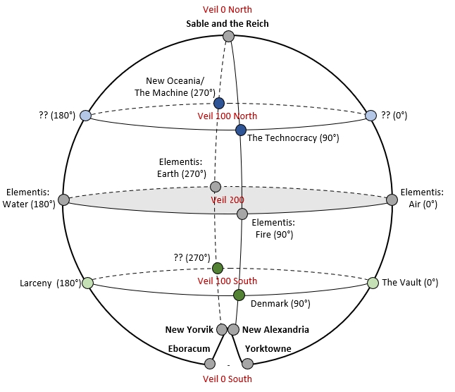 |
A topographical depiction of the “Earth” Realms of the Inside, showing the placement of the known and assumed Powers. |
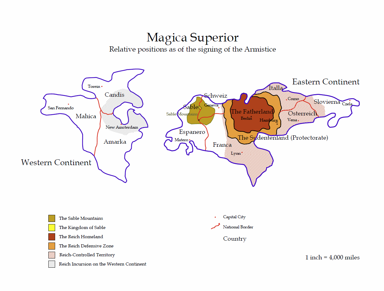 |
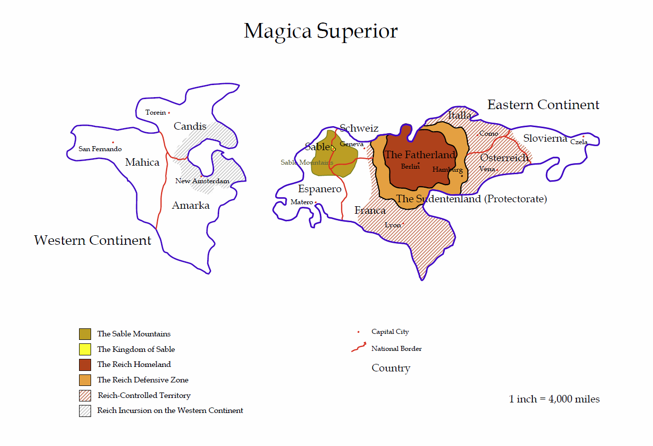
Political map of Sable/Magica Superior, the Sable Primal World, as of SY 154 |
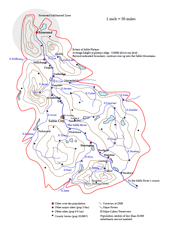 |
Map of the Kingdom of Sable |
 |
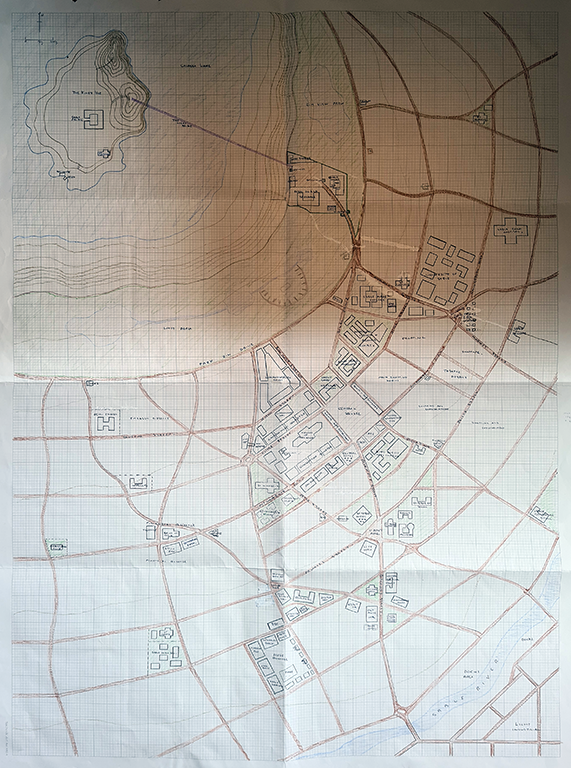
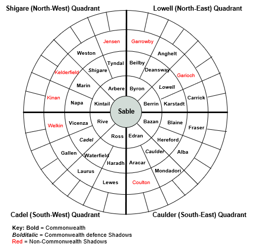
Approximate zoning map of Sable City |
 |
Detailed Map of Sable City (6MB file). The map split into four quadrants can be found here.
The full sized map can be found here (warning, 18MB file) |
 |
Topographical map of the closest Shadows to Magica Superior |
 |
Map of the Fatherland |
 |
Central area of the Reich capital, showing the major civic buildings |
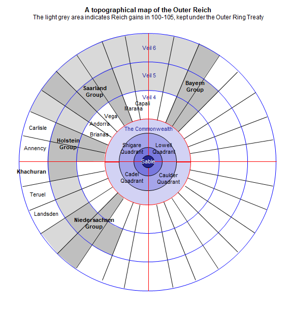 |
Topographical map showing the Outer Reich |
 |
Map including the names of the original Aussenhandel worlds, as well as the locations of the twelve Broken Patterns. |
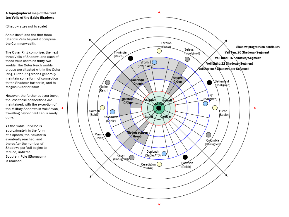 |
A rough representation of the progression of Shadows out from Sable |
 |
Magica Superior in SY 125 |
On the Outside |
|
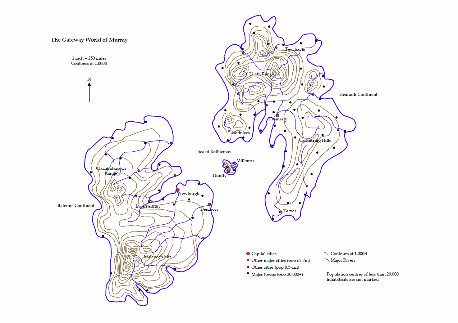 |
Murray, gateway world from the Outside to Sable |
 |
Rothiemay Island, Murray |
 |
Huntly City, capital of Murray |
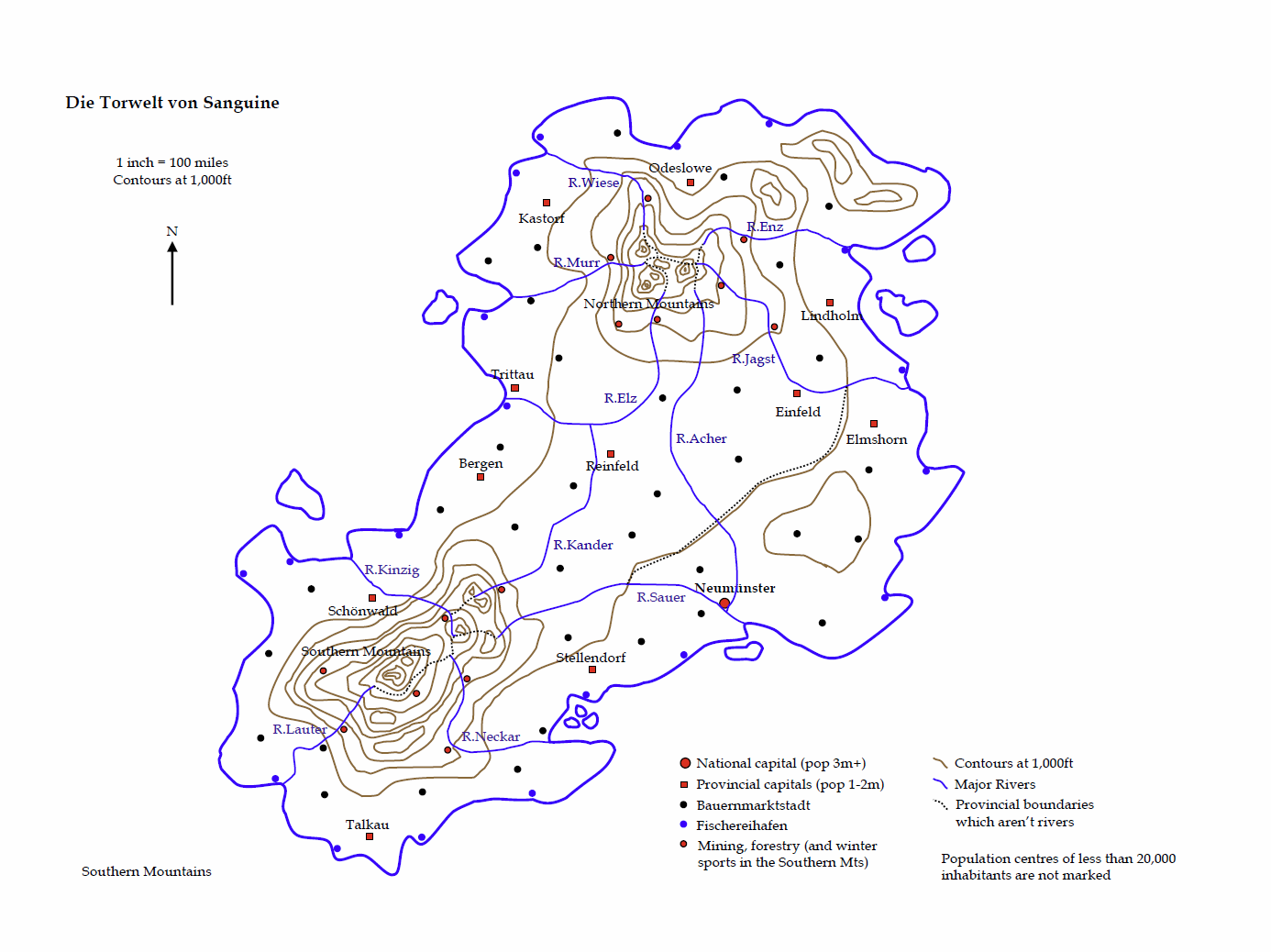 |
Sanguine, gateway world from the Outside to the Reich |
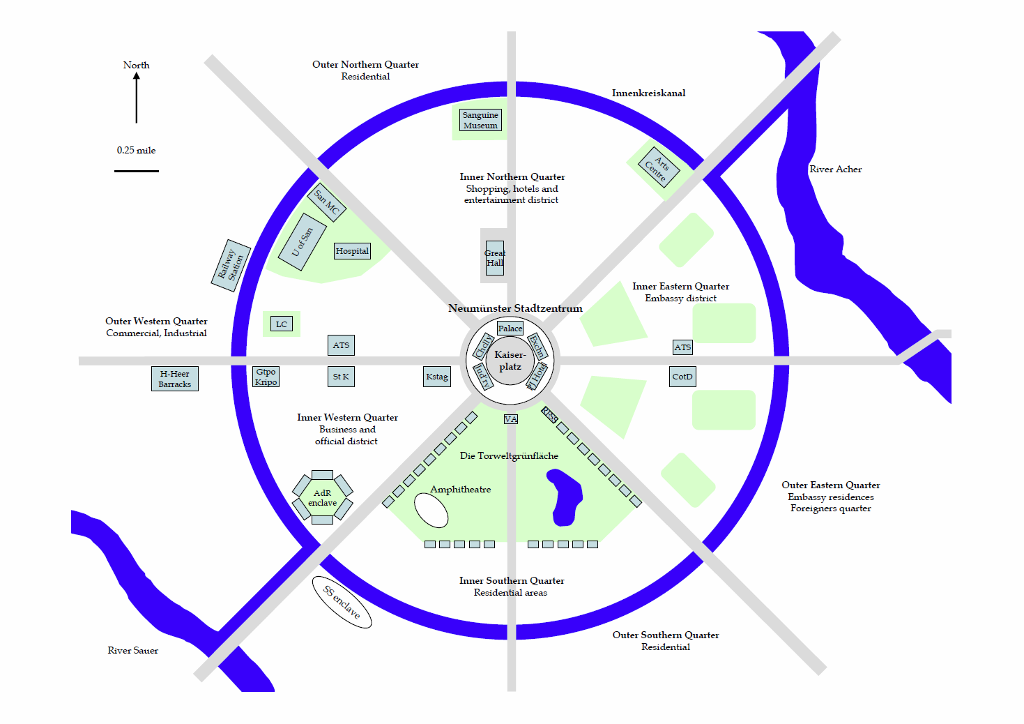 |
Neumünster, capital of Sanguine |
 |
A topographical depiction of the “Triad” of Murray, Sanguine, Seconde on the Outside Equator. |